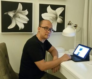
Dr. Andri Hernandi
Dr. Andri Hernandi was born in Bandung, Indonesia, in 1971. He received the bachelor degree in Geodetic Engineering from Institut Teknologi Bandung, Indonesia, in 1996. He continued study in Urban and Regional Planning Master Program from same Institute, in 2002. He studied fiscal cadastre and land value in spatial planning for his Master’s degree. Dr. Andri Hernandi obtained Ph.D degree in the field of Digital Photogrammetry from same institute, in 2009.
In 2002, he joined the Department of Geodetic Enginnering, Institut Teknologi Bandung, as researche assistant, and in 2009 became a Lecturer. In 2007-2012, He has actived as a member fo Indonesia Geography Expedition (EGI) Bakosurtanal and he has produce many popular article about the geography of Indonesia. His current research include land and marine cadaster (fiscal & legal), land value, land tenure, land management, land consolidation, land adminisitration, and digital photogrammetry. Dr. Andri Hernandi actived as an author in some international conference such as Federation Internationale des Geometres (FIG) and CoastGIS. He has received a grant from SEARCA, in 2011. He has over 10 years experience as Cadastre Expert.
